


National Weather Maps At-A-Glance
Severe Weather
 |
|
|
|
 |
Radar and Satellite Maps
 |
 |
Precipitation Maps - Rainfall and Snow
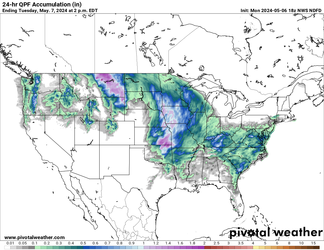 |
 |
 |
 |
Temperature Maps
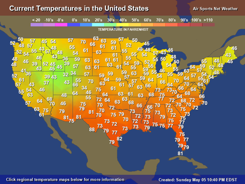 |
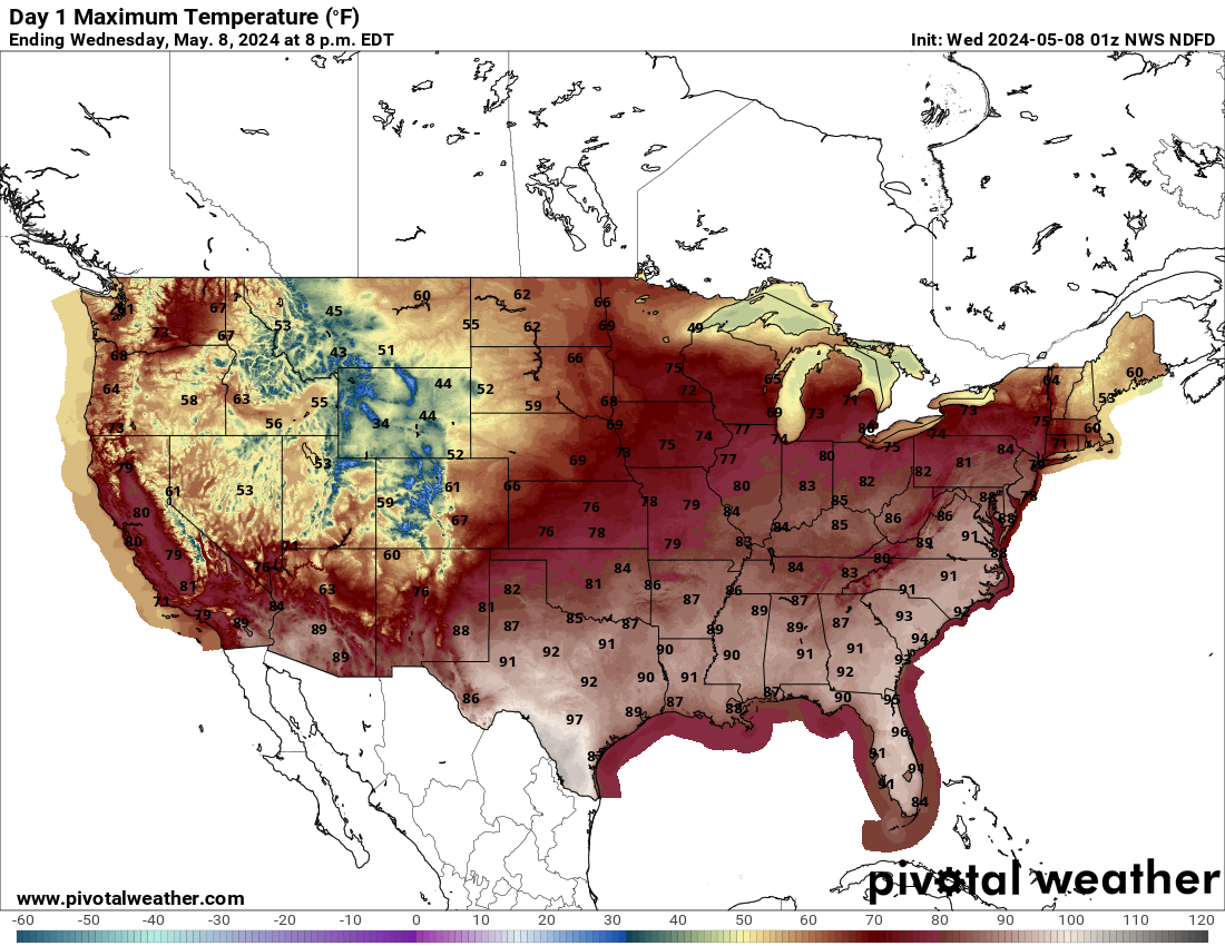 |
 |
 |
 |
 |
26°F at Chicago Aurora Municipal Ap, IL |
 |
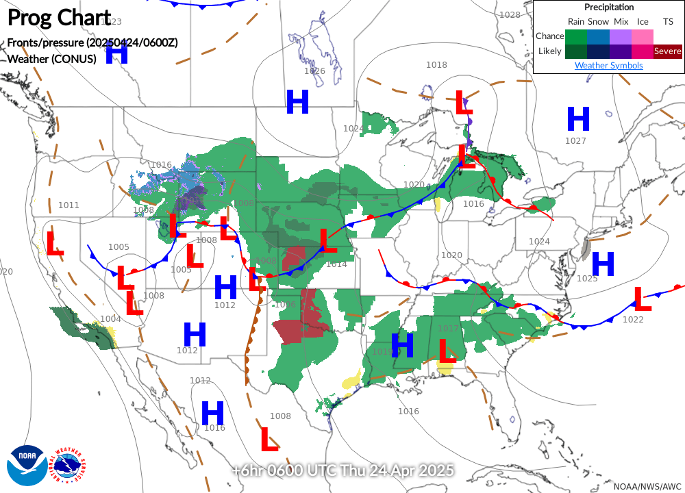
Surface Analysis
 |
|
|
|
 |
Fire and Drought
 |
 |
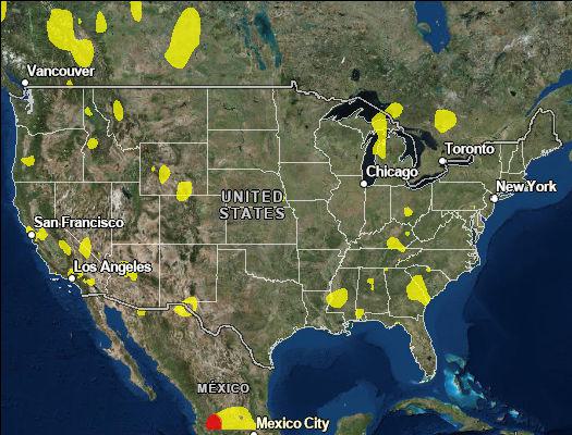
Air Quality
 |
 |
 |
 |